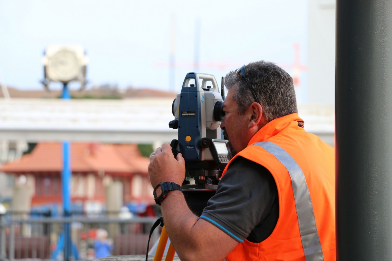
Accurately Measure And Map

We know land - inside and out, above and below. When you partner with CKL, you get people who’ve known and loved surveying for generations, backed by the latest technology and equipment.

We accurately measure and map development landscapes for title, subdivision, and construction. Your needs might be as simple as clarifying property boundaries, or as complex as tunnelling beneath existing infrastructure. CKL has the team, tools, and experience to deliver.

We save clients time and money by using drones to capture data on sites that are large, complex, or difficult to access. Using Part 102 CAA -certified UAV pilots and LIDAR scanning, we generate high-resolution aerial images, point cloud models, and georeferenced site maps. We use drone data to create clear, 3D visuals that help with planning, design, and site understanding.

We also support construction and infrastructure projects with electronic monitoring services, including tilt and vibration sensors that provide 24/7 real-time insights - ideal for foundation repairs, structural remediation, and ensuring site safety.

Our Surveying Capabilities Include:

  • Licensed Cadastral Surveyors
  • Precision boundary surveys and title clarification
  • Cadastral, topographical, and as-built surveys
  • Drone land surveys and aerial photography
  • 3D scanning and point cloud modelling
  • Orthographic and oblique drone images
  • Scaled floor plans and CAD-ready files
  • GPS surveys and drone flood modelling
  • 3D survey plans and interactive site maps
  • Infrastructure projects (roading, tunnelling, and rail)
  • Multi-dwelling, unit title, and strata developments
  • Surveys of quarries, landfills, and inaccessible sites
  • Structural monitoring (tilt and vibration sensors)
  • Resource consent and title amendments
  • Construction and building set-out
  • Expert witness services
Land Surveyor surveying the area
 

Focussed

We are at the forefront of the industry, incorporating sustainable design and engineering strategies into land development projects, big and small. We help create environments and build new communities where people love to live.
 

Integrated

CKL is a fully integrated consultancy providing land development solutions for clients across New Zealand and the Pacific. With offices in Auckland, Hamilton, Te Awamutu, and Tauranga, our team of planners, surveyors, and engineers ensure you always receive smart, practical advice — and outstanding results.
 

Awarded

CKL has earned a reputation for innovative engineering and survey design, delivering to a high standard and demonstrating a commitment to quality. Our continued success comes from the strength of our relationships with clients and partners. We listen to your ideas, understand your needs, and create a shared vision.


Take The Next Step

CKL can guide you through every step of the development process. Our in-depth knowledge of regional land and resource management regulations ensures you always have the best advice, whether you're subdividing, building, or developing.

Contact us today to talk with a licensed surveyor about your project.


Arrange a FREE consultation

If you are wondering how you can unlock the development potential of your property, please use the contact form below or email [email protected] to arrange a FREE initial consultation to discuss your project. Or alternatively, please call one of our land development experts in an office closest to your site.

Office *
 
How May We Help You? *
 
If Other
 
Physical Address of Property
 
First Name *
 
Last Name *
 
Email Address *
 
Mobile *
 
Comments


Auckland
Campbell Burrows 027 839 6889

Hamilton
Jonathan Gwyn 027 215 6347

Tauranga
John Sternberg 021 1950 286

Te Awamutu
Hamish Ross 027 215 6346

 
Copyright © 2020 CKL. All rights reserved.